On the afternoon of Tuesday, September 16, 2014, Moroccan authorities alerted Spain’s Guardia Civil that they have lost track of a small rubber boat full of migrants in the middle of the Alboran Sea, a body of water between the two countries. The Moroccans were growing concerned because they knew that the migrant boat was having engine trouble and was unlikely to make it to Spanish coast, putting dozens of people aboard in grave danger.
News
Eurosur tools play key role in boat rescue
2015-05-06
The Spanish authorities quickly initiated search and rescue operation (SAR) and began to patrol the sea in the area they hoped to find the missing 7-metre boat. But it was nowhere to be found.
At the same time, as part of a trial, a satellite was scheduled to take a radar scan of the area of the sea where the migrant boat was suspected to be in the evening. The image showed what appeared to be a small boat drifting north. Frontex immediately forwarded the information to the Spanish authorities. With time running out, the satellite image allowed the Spanish authorities to narrow down the area of the SAR operation.
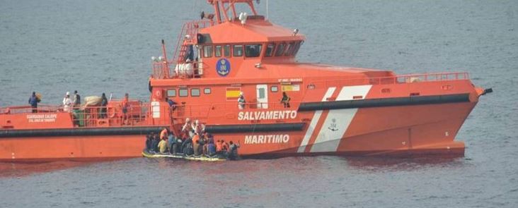
The following morning, a Spanish Maritime Safety Agency (SASEMAR) vessel tracked down the boat that had been drifting for three days. The 38 people on board, including eight women and three infants, were exhausted, but still alive.
The satellite photos that made the difference in the boat rescue were taken as part of an operational trial of services for Eurosur, an information exchange framework ran by Frontex to improve the management of Europe’s external borders.
The event points to the possibilities Eurosur offers to help save lives at sea, fight cross-border crime and deal with the wave of irregular migration at the EU frontiers.
“It’s very difficult to find small vessels in an open sea. That is why we are trying to make the most of state-of-the-art technology, such as satellite images. As the tools improve, we hope to be able to provide even better support to assist Member States,” said Dirk Vande Ryse, Head of Frontex Situation Centre.
The Eurosur services already include automated large vessel tracking and detection capabilities, software functionalities allowing complex calculations for predicting positions and detecting strange behaviours of vessels, as well as precise weather and oceanographic forecasts. Fusion Services use optical and radar satellite technology to help locate vessels feared to be engaged in people smuggling that often put the lives of migrants in danger.
In recent month, at the request of several member states, Eurosur has been used to track various cargo ships, some of which were suspected of being used to illegally transport people or goods.
Frontex experts keep an eye on the movement of these ships and the systems compare the location they report via an automated transponder to a ground station or satellite with satellite scans of the sea. If the locations do not match, it may be the first sign of illegal activity.
One such instance helped one member state to detain a ship carrying illegal cargo worth EUR 30 million.
Another Eurosur tool calculates a likely path a vessel would take, based on its type, weather conditions and other factors. Being able to have a better idea where a vessel may be heading allows national authorities to more quickly respond to emergencies at sea or criminal activities.
The backbone of Eurosur is a network of National Coordination Centres (NCCs), which group the authorities responsible for border surveillance in a given member state and coordinate the border surveillance activities on national level. The NCCs collect local and national information and share the relevant data with other member states and Frontex.